Know exactly where you
can fly your drone in Romania.
A live, interactive map of every UAV airspace restriction in Romania — restricted zones, control zones, permanent prohibitions and active NOTAMs — plus the tools to plan a flight and generate the official ROMATSA approval paperwork.
No account needed to explore the map · Pro tools come with a 7-day free trial.
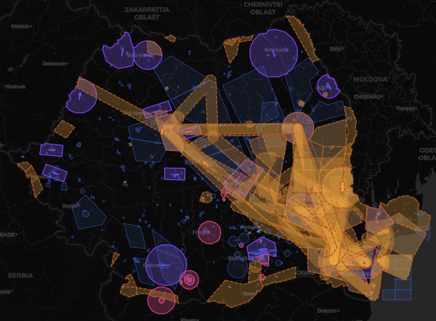
Every restriction, one map
RZ, CTR control zones, permanent LRP/LRR areas and live NOTAMs — colour-coded and searchable.
Live & self-updating
Pulled straight from ROMATSA and refreshed automatically — zones and NOTAMs stay current.
Draw & check overlaps
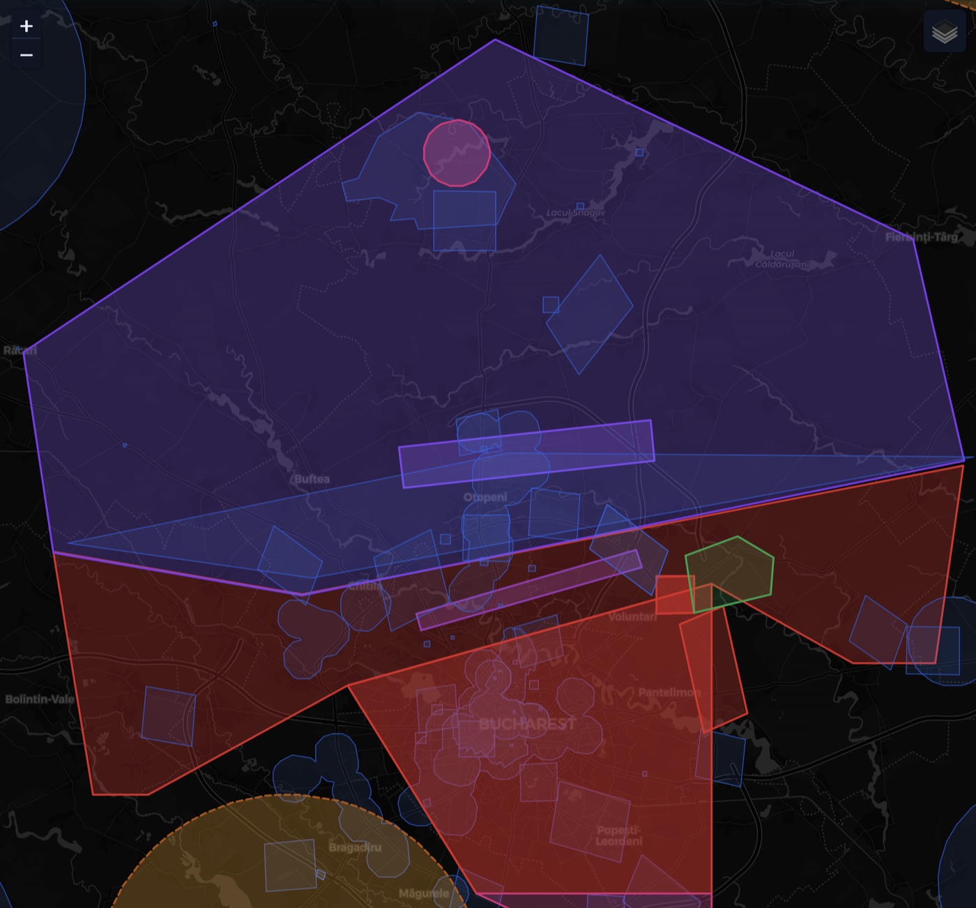
Sketch a polygon or a circle and instantly see which restrictions it touches, and their altitudes.
Official request PDFs
Auto-fill the ROMATSA Anexa 1 / Anexa 2 forms from your saved operator, pilot and drone details.
SORA Volume Planner
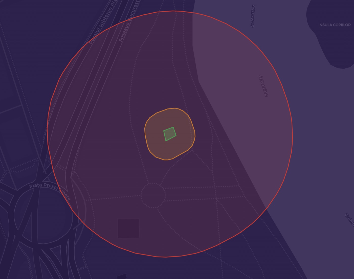
Build the operational volume — flight geography, contingency volume and ground-risk buffer — for Specific-category operations, and export it as KML.
Pilot flight records
Keep each pilot's log of flights and flight times (the AACR "evidența zborurilor"), with a running hours total, and download it as a Word (.docx) document.
Weather at your zone
Live wind, gusts and direction — plus temperature, cloud, visibility and a short forecast — for the centre of your planned flying zone, with a flyability read-out.
Places to fly
A curated list of scenic spots worth flying across Romania — each flagged for overlaps with restrictions, and openable straight into the planning tools.
See it in action
From the whole country down to a single operational volume.
Free to explore. Pro to plan.
Browsing the airspace is completely free. The planning toolkit — drawing, overlap analysis, exports and official request forms — is Pro, with a 7-day free trial.
Free
- ✓ Full interactive map of Romanian UAV airspace
- ✓ Restricted zones (RZ) & control zones (CTR)
- ✓ Permanent prohibitions & restrictions (LRP / LRR)
- ✓ Live ROMATSA NOTAMs, auto-updating
- ✓ Click any point to see every overlapping restriction — altitudes, contacts, NOTAM validity
- ✓ Grouped, searchable list & live cursor coordinates
- ✓ Browse a curated list of scenic places to fly
Pro
- ✓ Everything in Free, plus:
- ✓ Draw a planned flying zone — polygon, or circle by centre + radius (m / km / NM)
- ✓ Automatic overlap analysis against every restriction
- ✓ Export your flying zone as KML (Google Earth & GIS)
- ✓ Save flying zones to your account
- ✓ Operator, pilot & drone library
- ✓ Generate the official ROMATSA requests (Anexa 1 & Anexa 2), pre-filled & ready to sign
- ✓ Volume Planner — build the SORA operational volume (flight geography, contingency volume & ground-risk buffer) for Specific-category operations, with compliant KML export
- ✓ Pilot flight records — keep each pilot's flight log (AACR "evidența zborurilor") with a running hours total and download it as a Word (.docx) document
- ✓ Live weather for your flying zone — wind, gusts, direction, a short forecast and a flyability read-out
Both plans, one price when you go yearly: RON 550 / year = 11 months paid, 1 month free. Cancel anytime.
Simple pricing
Start with a 7-day free trial. Secure payment by Stripe. Cancel anytime from your account.
Ready to see the airspace?
Open the live map now — no sign-up needed to explore.
Launch the map →